Contour lines
Maps are a great application of utility graphics, but they also have to meet an aesthetic requirement. Even as a child, I was fascinated by the legends of maps, and I even had an aeronautical map of Iceland hanging on my wall for decoration for a long time. In more recent times, I have been concerned with the design aspects of map display on small navigation devices for bicycles.
While looking for motifs for my plotter graphics, I came up with the idea of using contour lines. In usual maps the representation is rather restrained, nevertheless – depending upon kind of sport – very important. If you use topologically interesting areas, the result is an exciting graphic.
When thinking about the implementation, I refrained from rendering exact elevation information (as in OpenTopoMap). Based on my experience with bike navs, the way to generate clean vector graphics just didn't seem worth the effort, especially since no actual accuracy is required.
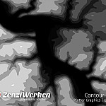
Instead, I used simple height maps (heightmaps). These are grayscale images which show high places bright and low places dark. You can find corresponding images for arbitrary map sections for example at Heightmapper or Skylines Map Generator. The pixel images can then be easily processed in an image processing program. For this I used the following corrections or filters:
- contrast adjustment
- Gaussian blur filter (to adjust the level of detail)
- Posterize (number of steps later results in the number of contour lines)
- Find Edges
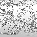
The result is vectorized to a line graphic. Illustrator has the advantage over other systems (e.g. Potrace) that lines are recognized as single lines and not as areas.
Since it is not easy to display different line thicknesses with a plotter, I simply converted thicker lines with double lines. This gives the impression of the larger height jumps.
[UPDATE] In the meantime, another online service has come to our attention that allows us to create suitable contour lines very quickly: https://contours.axismaps.com/


