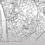
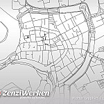
City roads
As already mentioned at the Contourlines, I find the generation of vector graphics from OpenStreetMap very bulky. Already the Wiki of OpenStreetMap shows many different ways to generate vector data. However, when plotting map material, one must keep in mind that the level of detail must not be too high. Otherwise the plotting process will take extremely long.
A quite comfortable possibility offers a tool by Andrei Kashcha called city roads. Simply search for the desired city and select the appropriate map section. Then you remove the flat background and scale the graphic to the desired size.
Unfortunately, all lines have the same properties, so that it is not possible, for example, to provide highways and federal roads with clearer lines. If necessary, one has to deal with a local installation of the software. Obviously, it is possible to export specific OSM tags and even provide them with different properties.

